Portal to the Past: You’ll Be Surprised By What You’ll Find! The Special Collections Edition!
- Elaine Harrington
- October 23, 2019
This is the final blog post in the series about the new wall design outside Special Collections & Archives. Over the last few weeks Emer, Emma and I have tried to dispell notions of what people think of may be in Special Collections or Archives. For Special Collections inevitably books is the first choice. However Special Collections is more than old 📖 or rare 📖 . There’s actually quite a lot to Special Collections including:
- items or collections donated by individuals
- unique collections of literary manuscripts
- 18th – 20th century newspapers
- books printed before 1850
- limited edition books
- theses
- maps
- pamphlets
- photobooks
- artists’ books
Choices, Choices
So when it came to deciding what to choose that fitted the criteria: visual, not necessarily a ‘treasure’ and representing the theme ‘portal to the past’ I had quite a bit to choose from. The final design has 14 images of varying sizes. Certainly it’s not possible to place all eleven images I initially selected, being that Archives Service also wished to select images from those collections. But what to place to one side for another time?
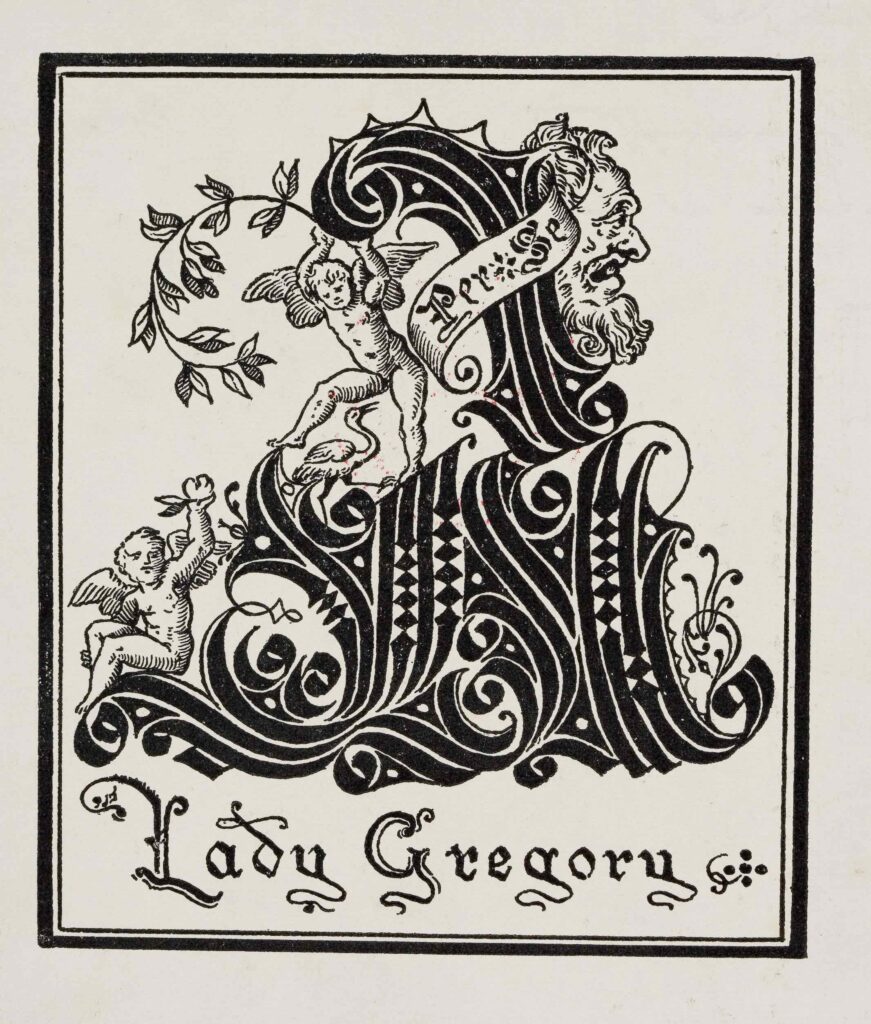
Lady Gregory’s bookplate from Popular Tales of the West Highlands.
Special Collections has many items that used to belong to many different people. A truly nerdy search would be a collection search ‘ex libris’ and limiting the results to items in Special Collections with some 13,500 results! One of the ways we identify who used to own a book is through bookplates. Bookplates can show names, mottoes, crests, coats of arms or pictorial scenes. One possibility was Lady Gregory’s bookplate placed on the paste-down of Popular Tales of the West Highlands (Manuscript Collection U.346). Lady Gregory is associated with the Irish Literary Revival, co-founding the Irish Literary Theatre and the Abbey Theatre with WB Yeats and Edward Martyn.
A second bookplate possibility was Histoire des Celtes: et particulièrement des Gaulois et des Germains (1771) which shows Henri Arbois de Jubainville’s bookplate with Robert Gibbing’s bookplate adjacent to it. Henri d’Arbois de Jubainville was a noted Celtic Studies scholar in the late 19th century and UCC Library acquired his collection in 1907. In 1908 under the Irish Universities Act Queen’s College Cork became University College Cork. Robert Gibbings, the Cork-born wood engraver and sculptor and who also attended UCC for three years designed a replacement bookplate for the Queen’s College Cork bookplate. The Gibbings’ designed bookplate was placed on the paste-down end-paper of many books acquired by the University Library from 1914 until at least the 1930s. The metal bookplate (U.238) is part of our manuscript collections.
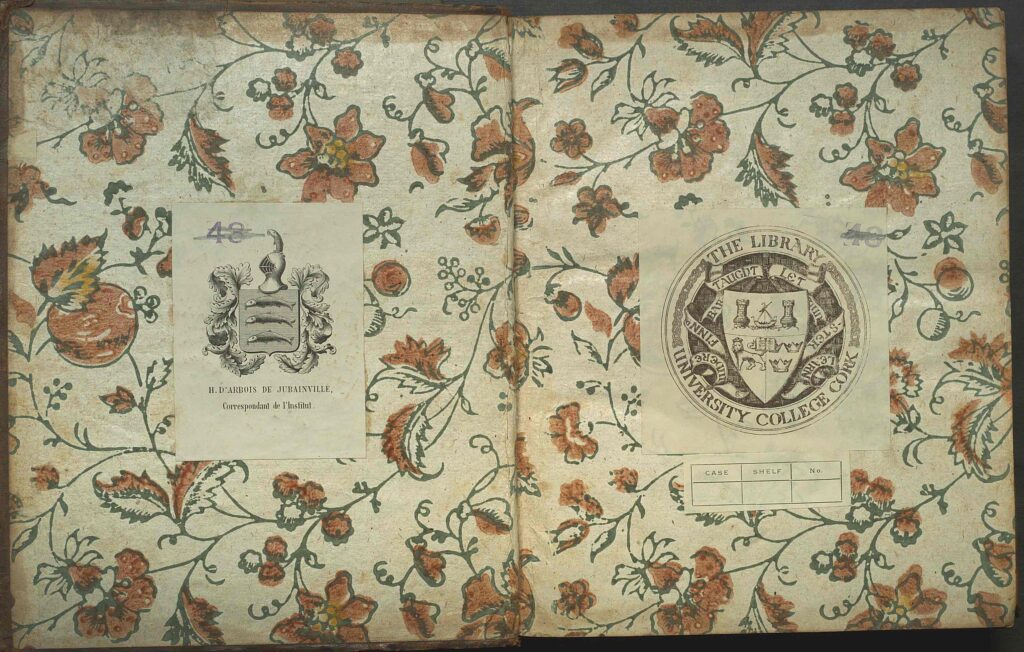
However none of these bookplate images were selected. Next year, 2020, is the 175th anniversary of the founding of the university, then known as Queen’s College Cork. To acknowledge the last near two centuries of acquisitions we included the Queen’s College Cork bookplate which is found on many items published before 1908. As we wanted to show the variety of formats present only one bookplate was possible but if you’re interested in others look at the Special Collections & Archives Art Subject Support page.
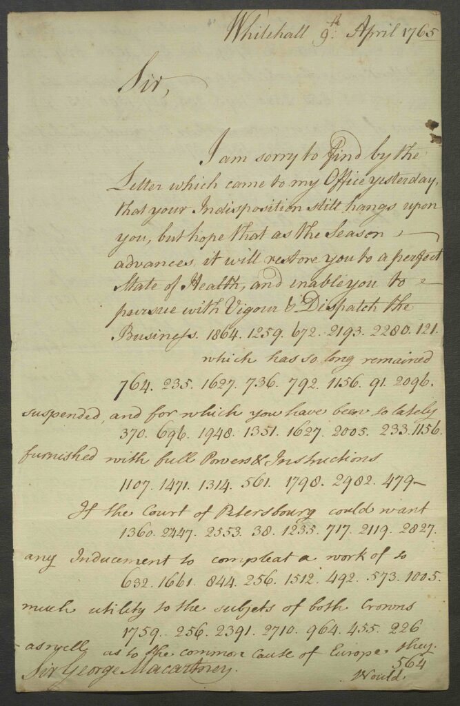
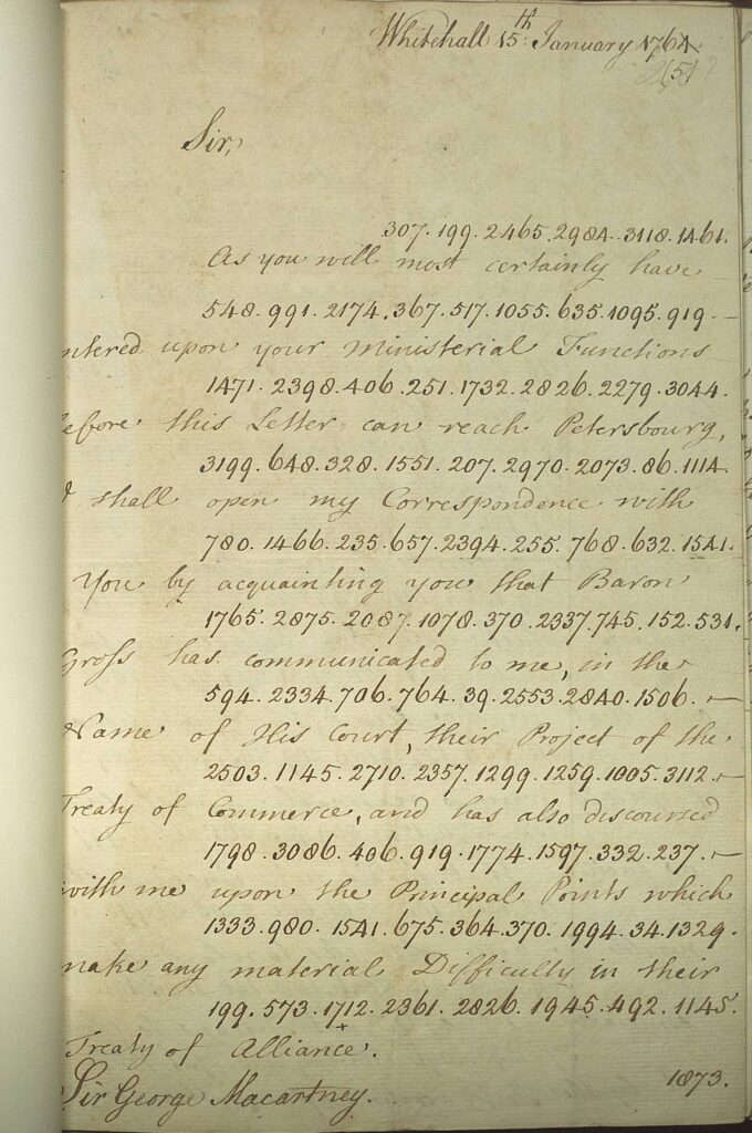
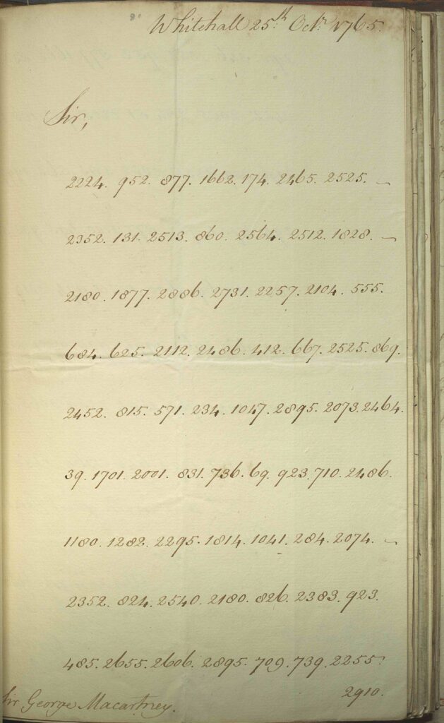
One of my favourite manuscript items was an early casualty of the criteria remit. This was Sir George Macartney’s official correspondence from his embassy to St Petersburg, 1765- 1766 [Manuscript Collection U.19]. The letters are a good early example of cryptography in use. The letters are written in code and then solved but only if one has the right cipher! In this manner diplomatic letters could be transmitted between St Petersburg and Whitehall without security breaches. The letters below show the range of what was written should be intercepted: nothing of consequence viewable followed by part of the letter in code and deciphered, an entire letter written in code and deciphered, and lastly an entire letter written in code but not deciphered. Unfortunately we don’t have the cipher but we’d be interested to hear if anyone has possible solutions.
Let’s Talk About the Wall
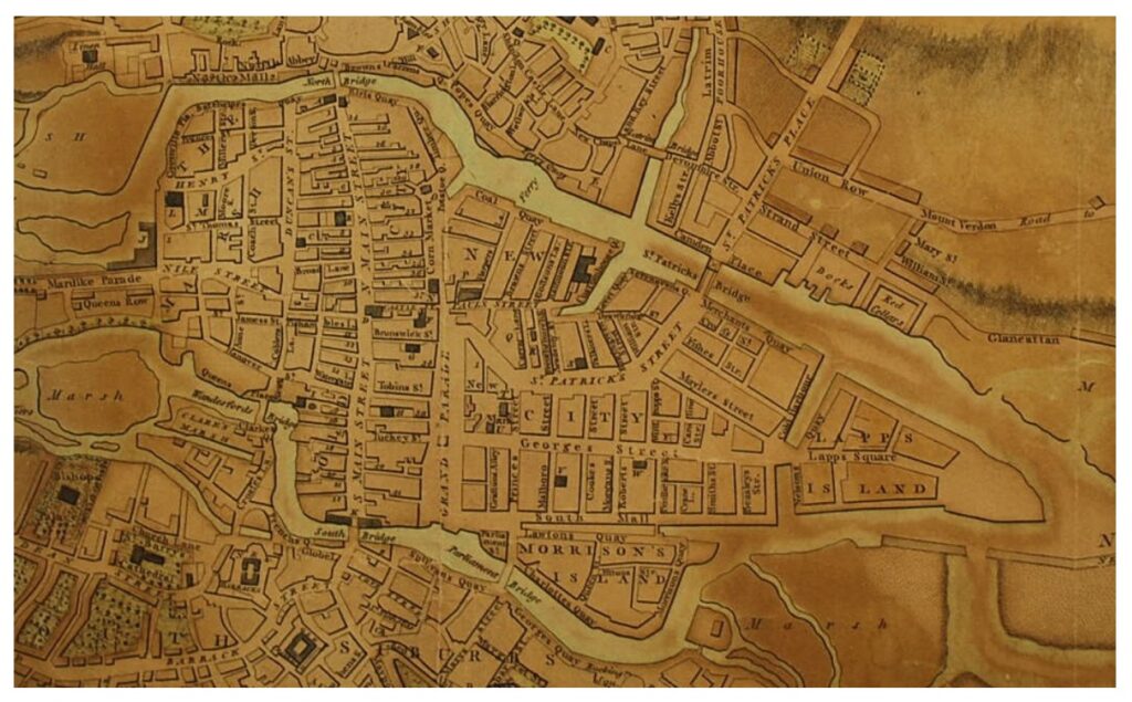
So let’s talk about the wall – not a Game of Thrones reference! If one bookplate was chosen and one of my favourite manuscript items wasn’t chosen, how did two maps come to be on the wall? I find that when people visit Special Collections that maps are easily relatable to. Quite often what makes it interesting is the level of detail or if the focus is on an area they know or if the area shows a different version of what they’re used to. This is despite most people now using an app on their phone for navigation. Beauford and Lindsay’s maps of Cork show different parts of Cork city and county over 200 years ago.
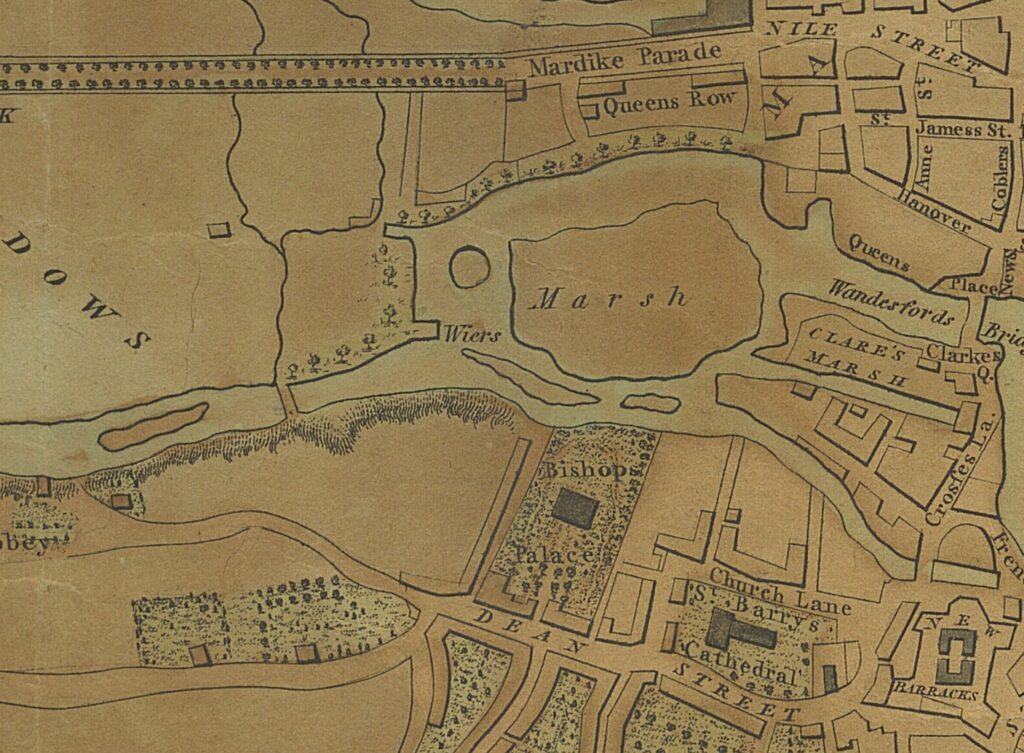
William Beauford’s Map of Cork c.1801
Below shows detail from William Beauford’s c.1801 Map of Cork. Beauford’s map shows the river channel which had previously run the course Patrick’s Street covered over and as a street. Suddenly the bend in the street makes sense – it’s really a meander! This covering of the river channel took place between 1774 and 1789. The map is placed on the wall as if it’s a watermark so it’s slightly faded. However the magnification on the map is amazing! When I see the map on the wall I can see the individual trees on the Mardyke and around St Fin Barre’s Cathedral. I could spell incorrectly and it would be fine because spelling wasn’t quite standardised at the start of the 19th century e.g. wiers not weirs!
A New and Correct Charte of the Harbour of Corke
A New and Correct Chart of the Harbour of Corke (1759) by the Rev. John Lindsay shows a different part of Cork. This is an ungraduated chart of Cork with two compass radiates. The soundings and shallows indicate what boats and ships may traverse the channel. The islands in the lower harbour are named: Great Island, Spike Island, Little Rocky Island, Great Rocky Island and Haulboling Island. In addition the map shows a variety of trees, buildings and boats. The map is dedicated to the Lords Commissioners for Executing the Office of Lord High Admiral of Great Britain. The scale on the map is ‘English miles’ and there is a note indicating that this map is a continuation of ‘Corke Harbour’ from a smaller scale.
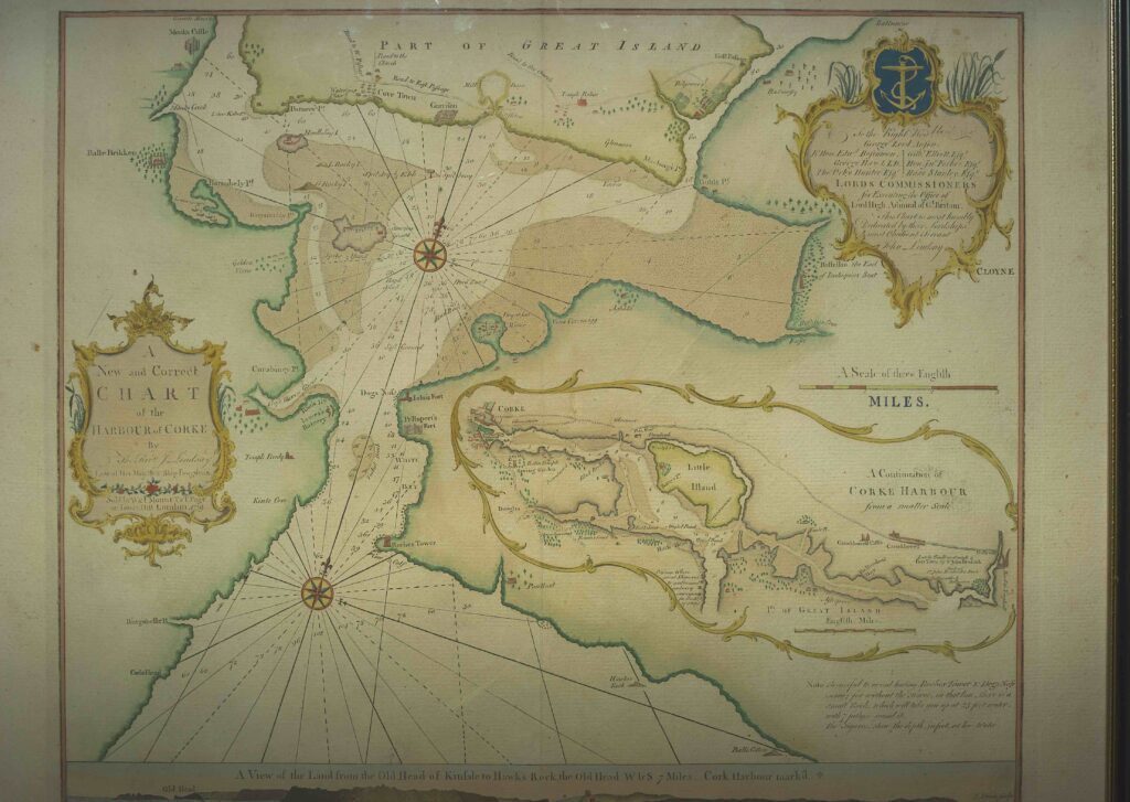

We first know of the Rev. John Lindsay as chaplain in the Royal Navy in 1755 and by 1757 he was chaplain on H.M.S. Fougueux (64 guns, 500 men). The chart of Cork is based on a survey started in 1757 when H.M.S. Fougueux was in Cork for a period. Lindsay had noticed that the old charts were “laid down by the antient rule of thumb and even in that way itself finished in a very bungling manner” (Voyage 13). When H.M.S. Fougueux returned to Cork as part of an expedition to French West Africa in 1758 Lindsay completed the chart. The chart was first published in A Voyage to the Coast of Africa in 1758 (1759). The map is sold by W&I Mount T&T Page on Tower Hill in London.
Irish Language Manuscripts
Special Collections has over 300 Irish language manuscripts across four collections: Torna, Murphy, Power and a general collection. Many of these are written by the same scribe and one such scribe is Pádraig Ó Standúin. Pádraig Ó Standúin or Patrick Stanton lived on Evergreen Street in Cork. In the 1901 census he describes himself as an ‘Irish interpreter.’ Shown here is the title page of Ls 202: Focalóir póca bhéarla agus gaedhilge (1890). Ls 202 contains a Focalóir póca bhéarla agus gaedhilge or Pocket dictionary in English and Irish, an Ogham Craobh or an Ogham Branch, and a poem by Ó Standúin. He produced a number of Irish language manuscripts with this type of title page in the 1890s. In addition UCC holds other manuscripts scribed by Pádraig Ó Standúin are Ls 88, Ls 104, Ls 150, Ls 151 and Ls 199.
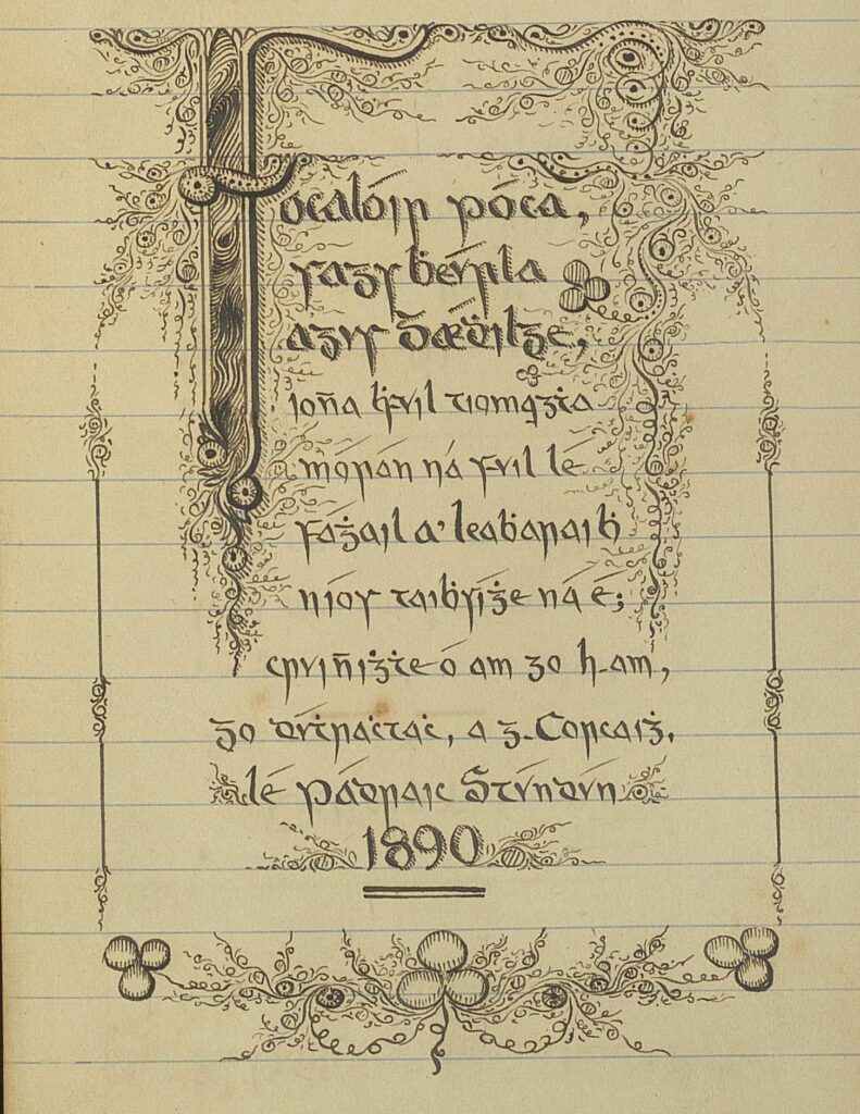
Title page to Ls 202 scribed by Pádraig Ó Standúin.
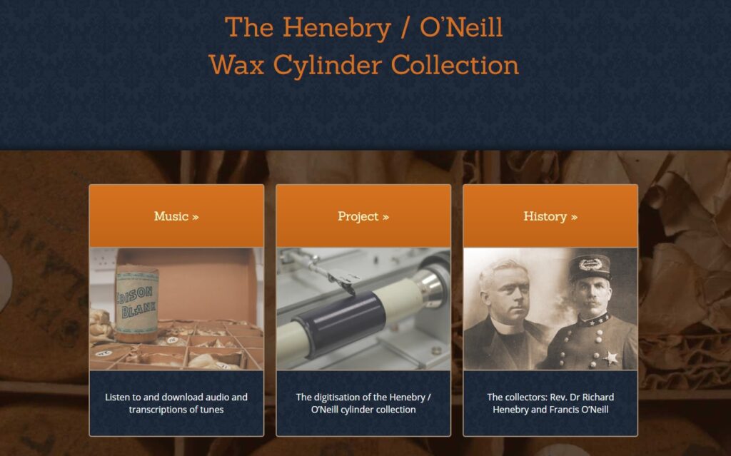
The last item to feature on the wall is the book cover to Francis O’Neill’s Irish Minstrels and Musicians: With Numerous Dissertations on Related Subjects (1913). Francis O’Neill was a collector of traditional Irish music in Chicago in the early 20th century. While Special Collections has many copies of this item this cover is part of the Irish Literary Society Collection. Francis O’Neill has inscribed the endpapers of this item: “To the distinguished Alfred Perceval Graves as a slight tribute from the author. Capt. Francis O’Neill, Chicago, U.S.A., Nov. 19, 1913.” The Irish Literary Society purchased the item from Graves in 1915 and this particular item features in an online display about the Irish Literary Society Collection. In 1907 Francis O’Neill sent field recordings on wax cylinders of the music he’d collected in Chicago to Prof. Richard Henebry in Cork. Henebry also collected traditional Irish music. These wax cylinder recordings have been digitised by UCC Library in collaboration with the Department of Music, UCC. The digitised collection also features as part of the CONUL Treasures online exhibition.
Where To Next?
Over the next few months the Special Collections & Archives team will post about new collections and different activities. If you’ve any comments about our new wall design please let us know!
