Community Week: Ye Olde Social Media
- Elaine Harrington
- November 18, 2019
This year Special Collections & Archives took part in UCC’s Community Week #MakingWaves. Community Week is a week long programme of free public events celebrating community engagement with UCC across our campus and beyond. During the year groups and communities partner with UCC and together we are making waves for a more inclusive, ethical and sustainable society. Special Collections & Archives held two show & tell workshops. We were inspired by our wall graphic “Portal to the Past” and drew our tag line from it: “Discover the social media and apps of times gone by.” We would take you on a journey to a time when…
…RTE News Was the Latest Decree!
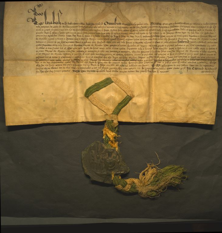
January 1569: This lovely example of a vellum (calf skin) document with attached seal (though not intact) are Royal letters patents creating Sir Maurice FitzGerald Baron of Dromana and Viscount of Decies. Take a closer look at the seal, what do you see? Letters patent are a legal instrument in the form of a published written order issued by a monarch, in this case Queen Elizabeth I, generally granting an office/title/right to a person or corporation. [T3131 A/1/38A, The Villiers-Stuart Collection, UCC Library Archives Service]
…Google Maps Was Cartography!
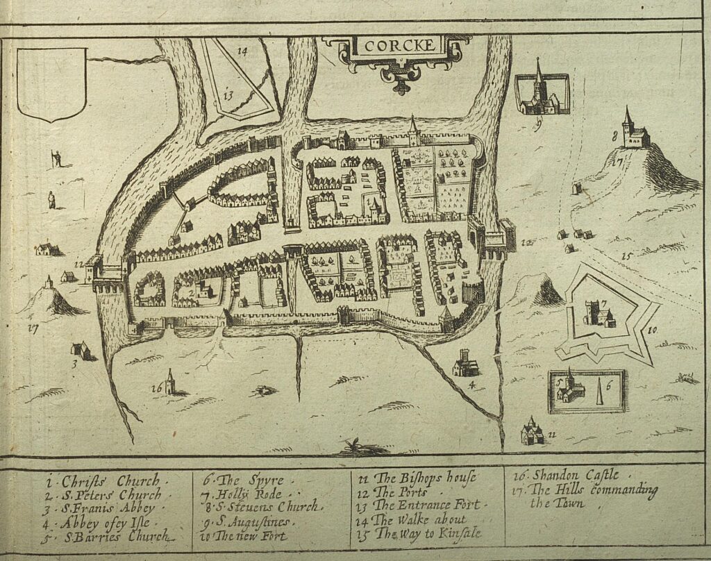
17th century: The Civitates orbis terrarvm is a magnificent work comprising detailed illustrations with commentaries of various cities. Apart from its visual splendour and its importance as a topographical work, it is useful for its depiction of costumes and customs. The atlas comprises 363 double plates with views /plans of over 500 cities and towns. Volume 6 containing maps of Ireland and Irish cities was published in 1617. Civitates orbis terrarvm was produced by Braun & Hogenberg. Georg Braun (1541 – 1622) was a topo-geographer and principal editor of the multi-volume work. Frans Hogenberg (1535 – 1590) created the tables for volumes 1-4. Civitates orbis terrarvm contains mostly European cities however Casablanca and Mexico City are also present.
We’re used to seeing Cork on a north/ south axis but here north is where we usually find the west! Cork of this time is only North and South Main Streets with laneways off both and the bridges crossing the river are actual gates. Elizabeth Fort or Star Fort is behind the then St Fin Barre’s Cathedral. See this image to see how close they really are! Underneath the map are the top places to visit in Cork at this time. However, some of these may have changed since! [U.314: Braun, Georg and Franz Hogenberg. Civitates orbis terrarvm. Coloniae Agrippinae: apud Petrum a Brachel, 1576-1617, 6 vols, Special Collections].
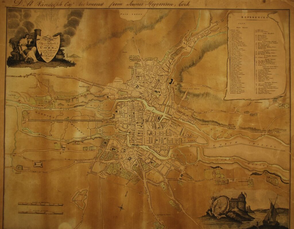
19th century: We also used William Beauford’s Map of Cork from 1801. As with the earlier map of Cork Beauford includes a hit list of places to visit. For more about changes to Cork shown on the map see here.]
…Twitter Was Postcards

19th / 20th century: This album of Cork city postcards shows the city and characters from the late 19th century through to the 20th century. Though most are blank, some were posted with a quick ‘update’ from the sender to the intended receiver on how they’re enjoying their time or something of note they’ve seen and want to share, much like a tweet.
This collection of late 19th century and early 20th century postcards was collected and compiled by Mr John James. The postcards are all sourced from towns in County Cork and the city and are arranged alphabetically. [BL/VC/PP/8, John James Postcard Collection, UCC Library Archives Service]
…Pop-up Ads Was Playbill Advertising
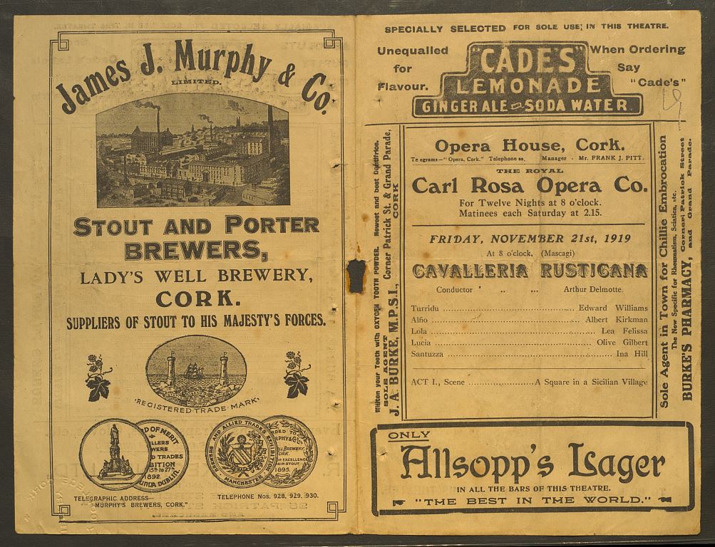
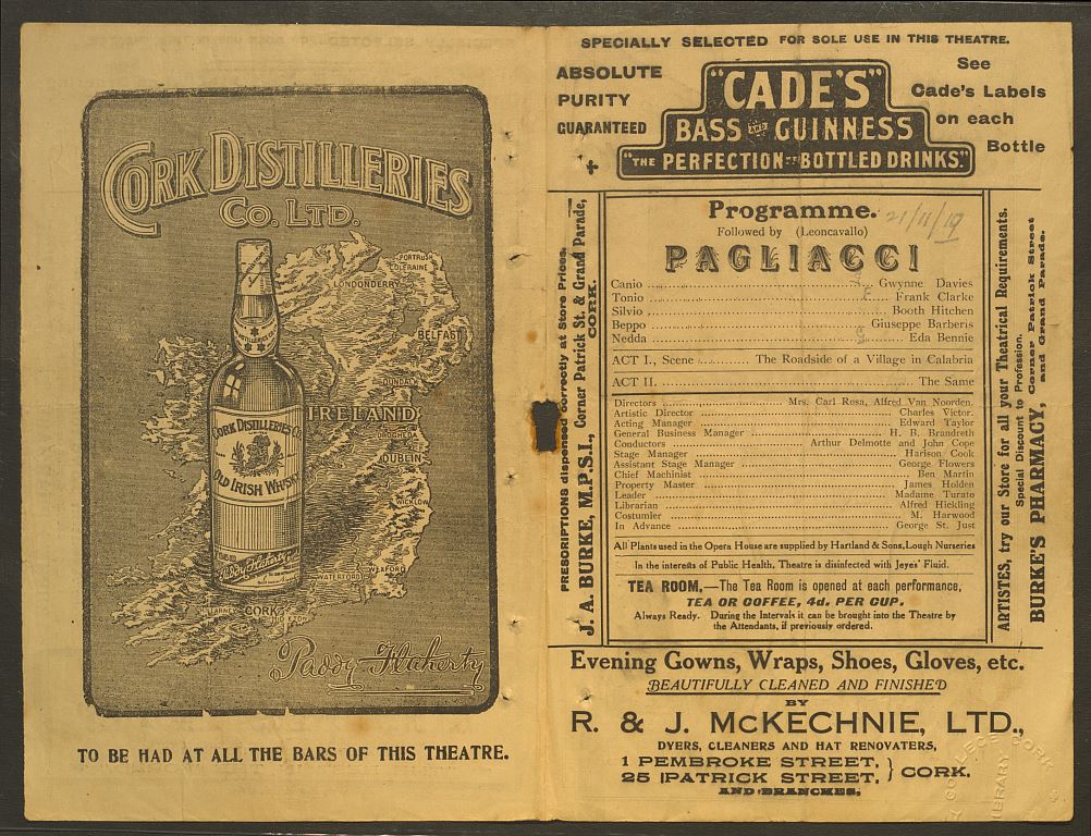
2oth century: We showed a series of playbills from the Opera House, Special Collections.
Each varies in content and size showing different advertisements and programmes. Some of the businesses and products still exist or are sold today. The item shown above dates from 21st November 1919, almost 100 years ago! [MP 792: Programmes of Opera House, Cork, Special Collections]
…Instagram Was Friedlander Designs!

20th century: Elizabeth Friedlander was a Jewish, German born, graphic designer. She was forced to flee Germany at the beginning of the second world war and went on to work in Italy and the UK settling in Ireland in her later years. She is most famously known for her designs of the iconic penguin for Penguin Books, and her Friedlander Borders. The Friedlander Collection is the largest visual collection in the archive and has been featured in exhibitions in both UCC and the Ditchling Museum of Art+Craft, UK. [BL/VC/EF, Elizabeth Friedlander Collection, UCC Library Archives Service]
…Blogging Was a Nature Book

20 Oct 1913 – 4 Oct 1918: This interleaved nature book belonged to Clodagh Leigh-White when she was a child and has handwritten notes and watercolour drawings of her observations of nature around the areas of Bantry and Glengarriff. There are lovely drawings of plants (sweet william, buttercup) and a woodcock that give us a little insight of what was growing and prevalent in these areas in the early 20th century. There are also very child-like fairy-tale drawings at the front and back (the frog prince) which may indicate what Clodagh had been reading at the time. This nature book is from the estate and family papers generated by the White/Leigh-White/Shelswell-White family of Bantry House, Bantry, Co. Cork. [BL/EP/B/2667, The Bantry Estate Collection, UCC Library Archives Service]
…Pinterest Was Scrapbooking

5 Aug 1916 – 31 Oct 1958: This album belonged to Geoffrey Shelswell-White during his time with the Colonial Service in Zanzibar and Gibraltar. There are newspaper cuttings on family, national and international events, invitations to Court and various official dinners, letters from family, and his travel plans. This gives us an accurate impression of his interests and activities. [BL/EP/B/2754, The Bantry Estate Collection, UCC Library Archives Service]
Community Week 2020
We look forward to seeing you during Community Week 2020 when UCC will celebrate its 175th anniversary!
